Asian Surveying & Mapping
Breaking News
Australian Space Agency funds development of aerospace-grade GNSS receiver
The Australian Space Agency has funded the development of...
Continuity risks for Australian EO data access
A new report details the widespread use of Earth...
China launches new remote sensing satellite
JIUQUAN, April 15 (Xinhua) -- China on Monday launched...
7.4-Magnitude Earthquake Strikes Taiwan
A major, 7.4-magnitude earthquake struck the eastern coast of...
Tata Deploys Its Geospatial Satellite In Space on Space X’s Falcon 9 Rocket
THIRUVANANTHAPURAM: Tata Company launched India's first private commercial satellite...
Taiwan’s Formosat-8 Satellite Set for Launch by 2025
The Taiwan Space Agency has announced progress on the...
Iranian Scientists to Build Satellite Constellation for 2 Simultaneous Missions
The scientists at the knowledge-based company had previously succeeded...
China provides geospatial intel and other military support to Russia, US says
The US has warned its European allies that China...
Japanese lunar lander company ispace raises $53.5 million in stock sale
WASHINGTON — Japanese lunar lander developer has raised $53.5...
Esri and Prince Sultan University Advance GIS Education Through Strategic Partnership
Memorandum of Understanding with Institution Enhances GIS Curriculum and...
CSIRO Debris

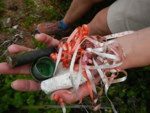
The researchers stop every 100 km to collect and catalog waste, including the tracking of barcodes found on litter in order to help determine where it was manufactured, packaged, sold, and transported to. Different beaches, no matter how remote, have contained different types of litter depending on their location, tides and currents.

Ultimately, the debris maps that are being produced will be matched with wildlife distribution patterns for marine species to produce risk maps that pinpoint the type of debris most dangerous to particular species. To date, a full third of the debris has been from the beverage industry with bottles, cans and straws a very common sight. A national database will be developed so that people can see all the data, and they will also be empowered to collect their own data.

The team have covered Melbourne, and are now traveling along the Victorian west coast to South Australia and then to WA.