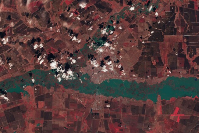

Monday, May 13th, 2024
Ural River levels peak in this April 13, 2024, enhanced color image from Landsat 9; vegetation appears red, while water is blue-green. After heavy rain and rapid snowmelt, rivers in southern Russia and northern Kazakhstan swelled, flooding homes...
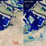
Monday, April 29th, 2024
A slow-moving storm system pummeled the United Arab Emirates (UAE) and dropped more than a year’s worth of rain on some cities in April 2024. Heavy rain triggered flash flooding across eastern parts of the country, inundating...

Tuesday, April 16th, 2024
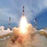
On April 15, 2024, China launched a Long March-2D carrier rocket, placing a remote-sensing satellite into space. The rocket blasted off from the Jiuquan Satellite Launch Center in northwest China and sent the Gaojing-3 01 satellite into...

Tuesday, April 2nd, 2024
UB students in Singapore mapping food waste across the island nation have earned the top prize in an international geospatial science competition. The team received the distinction award in the Association of Southeast Asian Nations’ (ASEAN) 2024...

Monday, March 18th, 2024
Synspective Inc., a Tokyo-based SAR satellite data and solutions provider, announced that StriX-3, its fourth SAR satellite, was successfully placed into its target orbit and spread its wings. StriX-3 was deployed into a Sun-synchronous orbit (SSO) at...

Tuesday, March 5th, 2024
The Japan Aerospace Exploration Agency (JAXA) is pleased to announce that the X-ray Imaging and Spectroscopy Mission (XRISM) completed its commissioning period as planned and has transitioned to the nominal phase. XRISM is conducting an initial calibration...
Friday, February 16th, 2024
Synspective, a Synthetic Aperture Radar (SAR) satellite data and analytics solution provider, entered into an agreement with the National Remote Sensing Department of the Ministry of Natural Resources and Environment of Vietnam and Fujitsu Vietnam. The National...
Monday, February 5th, 2024
The Japan Aerospace Exploration Agency (JAXA), along with the University of Aizu and Ritsumeikan University, released images captured by the Multi-Band Camera (MBC) onboard the Smart Lander for Investigating Moon (SLIM). After the moon landing and before...

Tuesday, January 16th, 2024
The Chinese Academy of Sciences (CAS) spacecraft Einstein Probe lifted off on a Chang Zheng (Long March) 2C rocket from the Xichang Satellite Launch Centre in China at Jan. 9, 2024. With the successful launch, Einstein Probe began its mission to survey the...
Monday, December 18th, 2023
Dr. Jitendra Singh, the Union Minister of State (Independent Charge) for Science & Technology, has said about ISRO's recent leverage of Artificial Intelligence (AI) and Machine Learning in space-related activities. Over the past three years, ISRO has...
