Asian Surveying & Mapping
Breaking News
Australian Space Agency funds development of aerospace-grade GNSS receiver
The Australian Space Agency has funded the development of...
Continuity risks for Australian EO data access
A new report details the widespread use of Earth...
China launches new remote sensing satellite
JIUQUAN, April 15 (Xinhua) -- China on Monday launched...
7.4-Magnitude Earthquake Strikes Taiwan
A major, 7.4-magnitude earthquake struck the eastern coast of...
Tata Deploys Its Geospatial Satellite In Space on Space X’s Falcon 9 Rocket
THIRUVANANTHAPURAM: Tata Company launched India's first private commercial satellite...
Taiwan’s Formosat-8 Satellite Set for Launch by 2025
The Taiwan Space Agency has announced progress on the...
Iranian Scientists to Build Satellite Constellation for 2 Simultaneous Missions
The scientists at the knowledge-based company had previously succeeded...
China provides geospatial intel and other military support to Russia, US says
The US has warned its European allies that China...
Japanese lunar lander company ispace raises $53.5 million in stock sale
WASHINGTON — Japanese lunar lander developer has raised $53.5...
Esri and Prince Sultan University Advance GIS Education Through Strategic Partnership
Memorandum of Understanding with Institution Enhances GIS Curriculum and...
pslv-launch

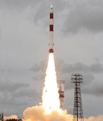
The Megha-Tropiques was launched in a low Earth orbit between 25 degrees North and 25 degrees South latitude at an altitude of 865 kilometers, inclined 20 percent relative to the equator. This vantage point will keep the satellite above the tropical belt to study humidity profiles, cyclones and flooding in the tropical zone. The orbit also keeps the satellite from flying over the French mainland, which is perhaps a first for a mission-funding country.

There are four instruments aboard the satellite:

  • Scanning microwave imager for detection of rain and atmosphere structures, developed jointly by CNES and ISRO
  • Sounder for probing vertical profiles of humidity from CNES
  • Scanner for radiation budget from CNES
  • Radio occultation sensor for vertical profiling of temperature and humidity, developed by Thales Alenia Space of France and Italy

Funding for the operation was split between ISRO (60% or Rs 90 crore) and CNES (40%), with an approximately total $98 million budget. This observation mission is just the second to to look at tropical climate globally, following on the NASA and Jpan joint mission of 1997. The mission is expected to last from three to five years time.

The three micro satellites that were launched alongside Megha-Tropiques include:

  • Jugnu- an Indian Institute of Technology-developed satellite designed to test a camera system that captures imagery in near infrared, along with evaluation of a GPS receiver and Inertial Measurement Unit (IMU) used for satellite navigation
  • SRMSat – a nanosatellite developed by students and faculty of SRM University that will monitor Carbon dioxide and water vapor using a spectrometer
  • VesselSat-1 – a microsatellite that carries the Automatic Identification System for ships, detecting signals from vessels at sea

You can watch a launch video here.