Asian Surveying & Mapping
Breaking News
Australian Space Agency funds development of aerospace-grade GNSS receiver
The Australian Space Agency has funded the development of...
Continuity risks for Australian EO data access
A new report details the widespread use of Earth...
China launches new remote sensing satellite
JIUQUAN, April 15 (Xinhua) -- China on Monday launched...
7.4-Magnitude Earthquake Strikes Taiwan
A major, 7.4-magnitude earthquake struck the eastern coast of...
Tata Deploys Its Geospatial Satellite In Space on Space X’s Falcon 9 Rocket
THIRUVANANTHAPURAM: Tata Company launched India's first private commercial satellite...
Taiwan’s Formosat-8 Satellite Set for Launch by 2025
The Taiwan Space Agency has announced progress on the...
Iranian Scientists to Build Satellite Constellation for 2 Simultaneous Missions
The scientists at the knowledge-based company had previously succeeded...
China provides geospatial intel and other military support to Russia, US says
The US has warned its European allies that China...
Japanese lunar lander company ispace raises $53.5 million in stock sale
WASHINGTON — Japanese lunar lander developer has raised $53.5...
Esri and Prince Sultan University Advance GIS Education Through Strategic Partnership
Memorandum of Understanding with Institution Enhances GIS Curriculum and...
3DCoast

“We have initiated work on the multi-hazard vulnerability mapping of the entire coastline and will then identify the most vulnerable areas from the hazard point of view to set up the ‘3D GIS’ maps for those selected areas,” INCOIS Director Satheesh C Shenoi said. 

Recently completed vulnerability maps of Nagapattanam in Tamil Nadu and the Nellore district in Andhra Pradesh have demonstrated the value and the methods for this large project.

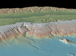
The agency, which houses the Indian Tsunami Early Warning Centre, will map all coastal hazards arising from sea level rise, coastal erosion, wave action, storm surges and tsunamis. 3D maps will be of particular interest to disaster management authorities in the event of a tsunami as they will provide accurate information of the areas that may be inundated, along with details of the populations that will be affected.

A panel of experts are working to finalized the methodology for mapping process.