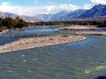

The source of the Brahmaputra, Indus, Salween and Irrawaddy rivers was reported this week from scientists at the Chinese Academy of Sciences (CAS). Using satellite imagery, Liu Shaochuang, a researcher with the Institute of Remote Sensing Applications at CAS reported the findings. Working on the expedition operating between 2007-2010, the project included both field trips and remote sensing tools and technologies.
“Previously, the sources of the four rivers were never clearly designated, and differing accounts regarding their lengths nd drainage areas confused researchers for many years due to restrictions of natural conditions and surveying and mapping technologies, said Liu Shaochuang, a researcher with the Institute of Remote Sensing Applications under the CAS,” reported Xinhua.
Accomplishing this work depended upon updated remote sensing technologies. Today, satellite imagery has higher resolution and landscape features and spectral analysis often help to identify and delineate these landscape features.
The Salween River, “is an international river, originating from Tangula Mountain of the Himalayas in the Tibetan plateau. The Salween then flows southward through Yunnan Province of China, down through Shan and Kayah States in the East of Burma (Myanmar), and along the Thai-Burma border, passing through Kayan and Mon States (Burma), and emptying into the Gulf of Martaban in the Andaman Sea,” as described by Salween Watch.